On the Road is a weekday feature spotlighting reader photo submissions.
From the exotic to the familiar, whether you’re traveling or in your own backyard, we would love to see the world through your eyes.
Good Morning All,
This weekday feature is for Juicers who are are on the road, traveling, or just want to share a little bit of their world via stories and pictures. So many of us rise each morning, eager for something beautiful, inspiring, amazing, subtle, of note, and our community delivers – a view into their world, whether they’re far away or close to home – pictures with a story, with context, with meaning, sometimes just beauty. By concentrating travel updates and tips here, it’s easier for all of us to keep up or find them later.
So please, speak up and share some of your adventures and travel news here, and submit your pictures using our speedy, secure form. You can submit up to 7 pictures at a time, with an overall description and one for each picture.
You can, of course, send an email with pictures if the form gives you trouble, or if you are trying to submit something special, like a zipped archive or a movie. If your pictures are already hosted online, then please email the links with your descriptions.
For each picture, it’s best to provide your commenter screenname, description, where it was taken, and date. It’s tough to keep everyone’s email address and screenname straight, so don’t assume that I remember it “from last time”. More and more, the first photo before the fold will be from a commenter, so making it easy to locate the screenname when I’ve found a compelling photo is crucial.
Have a wonderful day, and enjoy the pictures!
Today, pictures from valued commenter ?BillinGlendaleCA.
The First Hike
On October 9, 2015, I took delivery of my current camera, the Samsung NX500. I decided to take a hike up in Griffith Park to “break it in” and hike a part of the park I’d not been to before. The hike began at the Old Zoo which was all decked out for evening hay rides for Halloween. The Old Zoo was actually the LA zoo’s second location, the first being in east LA’s Lincoln Park before moving to Griffith Park in the 1920’s and moving from this location to it’s current location about a half mile north in the 1960’s. The hike route went a north and west up the hill to Vista Del Valle Drive(a road that’s been closed to traffic since the early 90’s) and up a short but steep trail(affectionally known as “Cardiac Hill”) to the trail that goes south to Mt. Hollywood. Then the route goes down the east side of Mt. Hollywood to Daunte’s View and down the single track trail down a ridge known as the “Hogback”(it looks like the back of a hog from Glendale). At the bottom of this trail is a bridge over a ravine and then the trail loops around Glendale Peak(it’s more of a hill) to the Helipad. Continuing east to make the short climb to Beacon Hill(they used to have a beacon up there to guide flyers to Glendale’s Grand Central Airport) which is the easternmost mountain in the Santa Monica range.
In addition to me getting a good workout, I really wanted to get a good idea what the camera could do so I kept it in “Manual” mode and manual focus. I think this is a really good way to adapt to a
new DLSR(or mirrorless) camera. The one thing that I failed to take into account with this approach(I was using the camera’s display to focus and set the exposure) is that I was wearing sunglasses and every exposure came out a bit overexposed. Fortunately I was shooting in RAW so it wasn’t a major problem to correct this in Lightroom.The Old Zoo
Taken on 2015-10-10
Old Zoo, Spring Canyon, Griffith Park, Los Angeles, CA
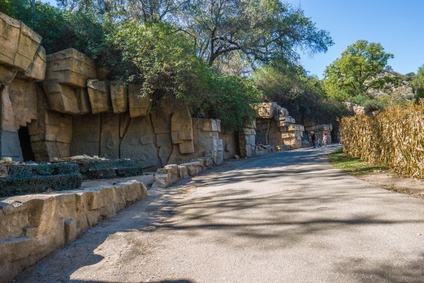
As I noted above, this was the LA Zoo from the 1920’s to the early 1960’s. Most of the enclosures(and they’re really small) were built by the WPA in the 1930’s. This is now a picnic area. It was heavily damaged in the 2007 fire but has recovered quite well.
Bee Rock
Taken on 2015-10-10
Old Zoo, Spring Canyon, Griffith Park, Los Angeles, CA
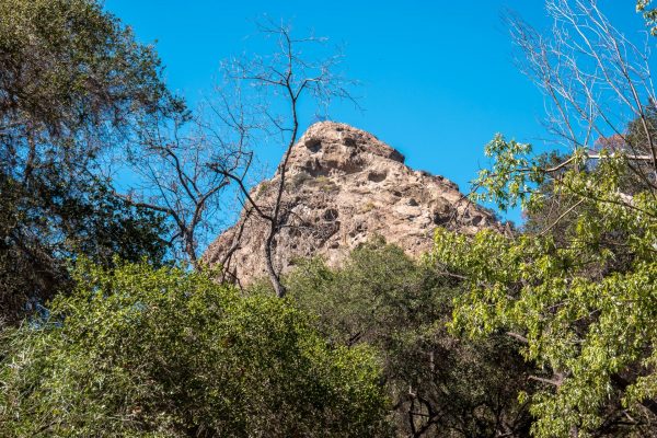
Bee Rock towers to the west over the Old Zoo and looks sort of like a bee(the face, I think).
Dante’s View
Taken on 2015-10-10
Dante’s View, Griffith Park, Los Angeles, CA
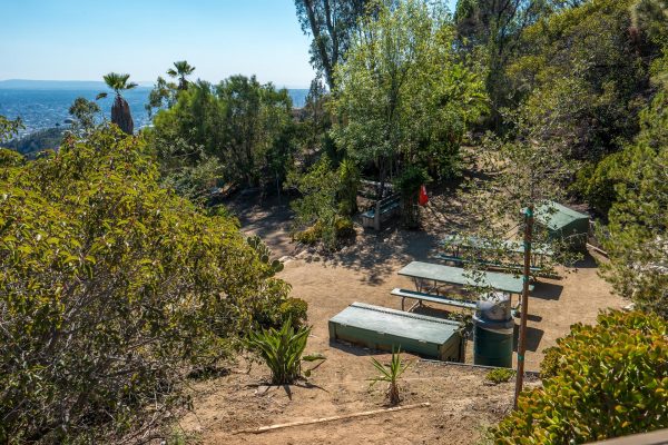
In my post about Mt. Hollywood, had a photo of Daute’s View(well the view from there); this is what the garden there looks like. There are some nice picnic tables where you can have lunch or just a snack and enjoy the fabulous view.
The Hogback Trail
Taken on 2015-10-10
Hogback Trail, Griffith Park, Los Angeles, CA
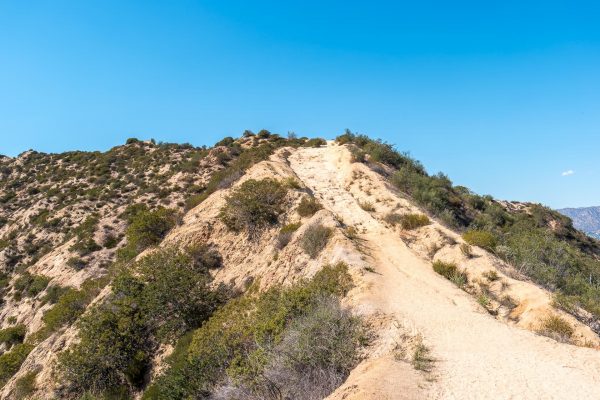
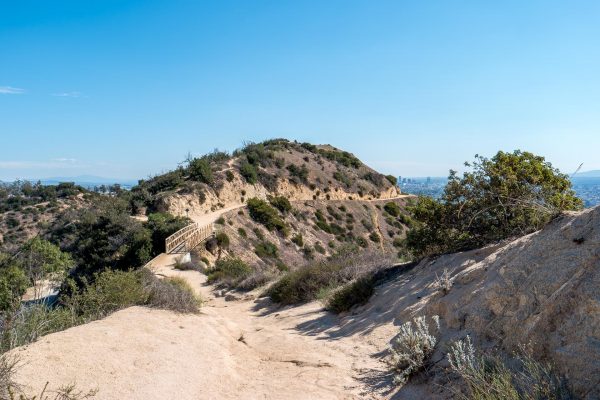
The Hogback trail is only about 1/2 a mile long but can get pretty steep in places(like you see in the picture). After going down this trail, I vowed never to do that again(I’ve hiked up it since then). This whole area burned in the 2007 fire.
The Bridge
Taken on 2015-10-10
Hogback Trail, Griffith Park, Los Angeles, CA
This little bridge is at the eastern end of the Hogback trail. Glendale Peak is in the center of the photo with the trail curving around it to reach the Helipad. You can Vista Del Valle Drive at the lower left.
View from the Helipad
Taken on 2015-10-10
Griffith Park Helipad, Griffith Park, Los Angeles, CA
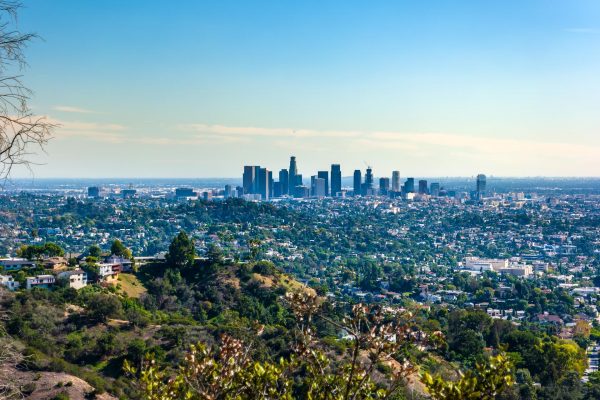
A view of Downtown Los Angeles from the Griffith Park Helipad. The Helipad is on Vista Del Valle Drive and is often used for filming commercials.
Downtown LA from Beacon Hill
Taken on 2015-10-10
Beacon Hill, Griffith Park, Los Angeles, CA
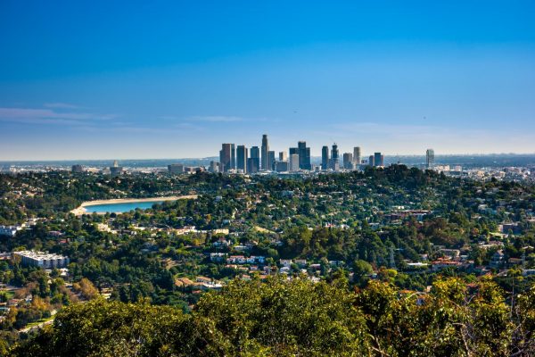
This is one of my favorite pictures of Downtown LA(I had it printed on metal and it’s hanging in the cave) since it has Silverlake in it. The were draining Silverlake to put a pipeline though the bottom of it and it was empty for about 18 months(they’ve just refilled it.) Silverlake used to provide drinking water but all of the open air reservoirs no longer serve that function in Los Angeles. Currently there are plans to turn it into a park.
Thank you so much ?BillinGlendaleCA, do send us more when you can.
Travel safely everybody, and do share some stories in the comments, even if you’re joining the conversation late. Many folks confide that they go back and read old threads, one reason these are available on the Quick Links menu.
One again, to submit pictures: Use the Form or Send an Email

eclare
Nice photos and thanks for the commentary! Made me feel like I was on that hike. And I agree that hiking downhill is much more strenuous than hiking uphill.
OzarkHillbilly
Too much sun! But it looks like a fun hike.
Baud
It’s always sunny in SoCal.
debbie
Beautiful! Is the rock formation in the first picture man-constructed, like Central Park in NYC?
rikyrah
Great pictures Bill ??
Elmo
Amazing shot of downtown, and something you could never have captured twenty years ago. Huge environmental success story: clean air in the LA Basin.
Elizabelle
@Elmo: Yes. That is so good to remember. Clean air.
?BillinGlendaleCA
@eclare: Thanks, the hike down the Hogback was steep and I was a bit afraid I’d take a tumble.
?BillinGlendaleCA
@OzarkHillbilly:
@Baud: The cloudy and wet season doesn’t arrive until November.
?BillinGlendaleCA
@debbie: Yup, those rock formations were built by the WPA in the 30’s.
?BillinGlendaleCA
@rikyrah: Thanks.
?BillinGlendaleCA
@Elmo:
@Elizabelle: Twenty years ago wouldn’t have been that bad; 40 or 50 years ago, the view would have been impossible. We still get hazy days, but it’s mostly marine layer from the ocean.
debbie
@?BillinGlendaleCA:
Thanks.