On the Road is a weekday feature spotlighting reader photo submissions.
From the exotic to the familiar, whether you’re traveling or in your own backyard, we would love to see the world through your eyes.
There is something special about forests, I think, where a hush falls over everything and the world feels different somehow. Of course, I’ve never been to a forest that has a waterfall, so that may be a completely different experience. The last photo with the fall color is fantastic.
The Ramona Falls trailhead is about an hour and twenty minute drive from PDX (unless you take a wrong turn like I did!). There are several campgrounds in the last 5 miles or so but because I went in October there was hardly any cars or people. It was also lightly raining. The falls are on the west slope of Mt Hood and I’ve heard the weather can be vey unpredictable. The trail is mostly an out and back with a loop option for part of the hike (I guess this trail is popular on horseback and the loop has “gates” to prevent riders from taking the loop section, I’m not sure if this works or why they did it). I saw exactly two cars at the trailhead parking lot and two hikers the entire hike. Although the surface is often soft dirt, needles, and is very quiet, I did not see any animals and heard very few birds, it was one of the quietest hikes I have ever been on.
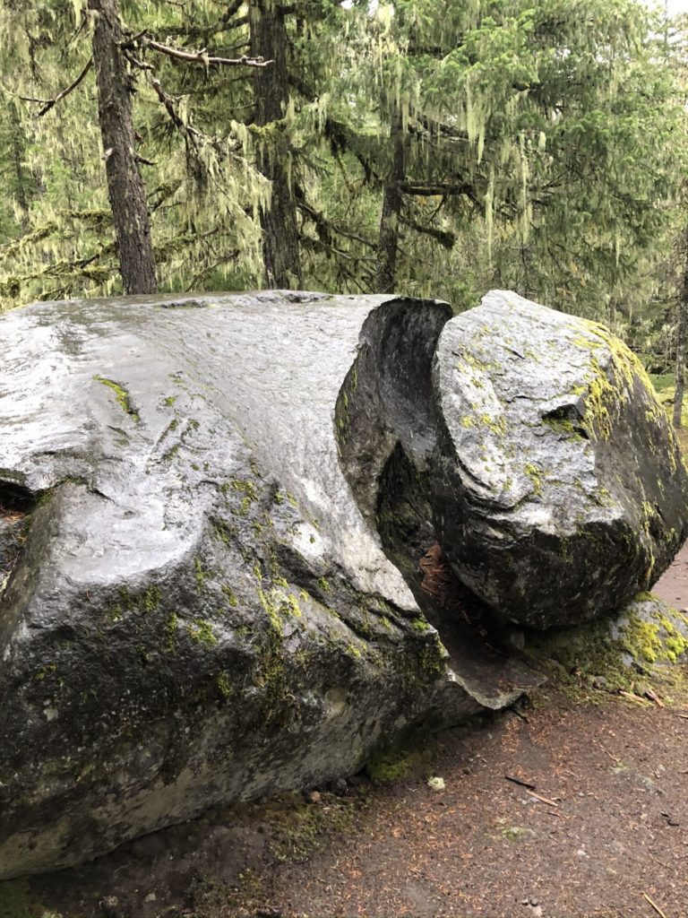
A couple hundred yards from the trailhead is this massive rock, looking very out of place. This is certainly a very unusual crack as well.
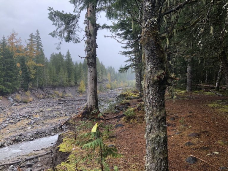
The trail follows the Sandy River for about the first 2/3 and in August of 2014 there was a massive landslide that came down the river. I was not aware of that at the time and I started to see huge carved out sections and wonder what had happened.
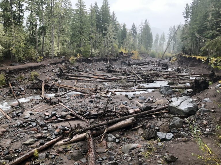
The trail used to have some bridge or method to cross the Sandy and this devastation is what was left of that. There are youtube videos and plenty of google results of the event. It stranded hikers and swept others into the river. I can say it was very humbling to stand where that raging torrent was and reckon the power it took to carve this giant ditch that goes on for miles.
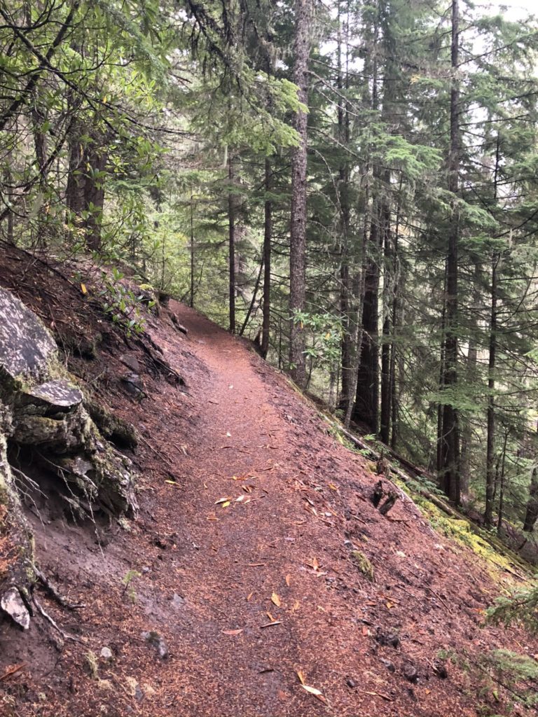
The trail starts to rise and move away from the river, the woods and the views in this area were wonderful. This forest has a very Northwestern U.S. smell (which I love) and it was incredibly quiet and peaceful. I was worried about losing daylight and the trail being in such good shape helped me keep good time.
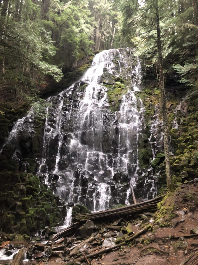
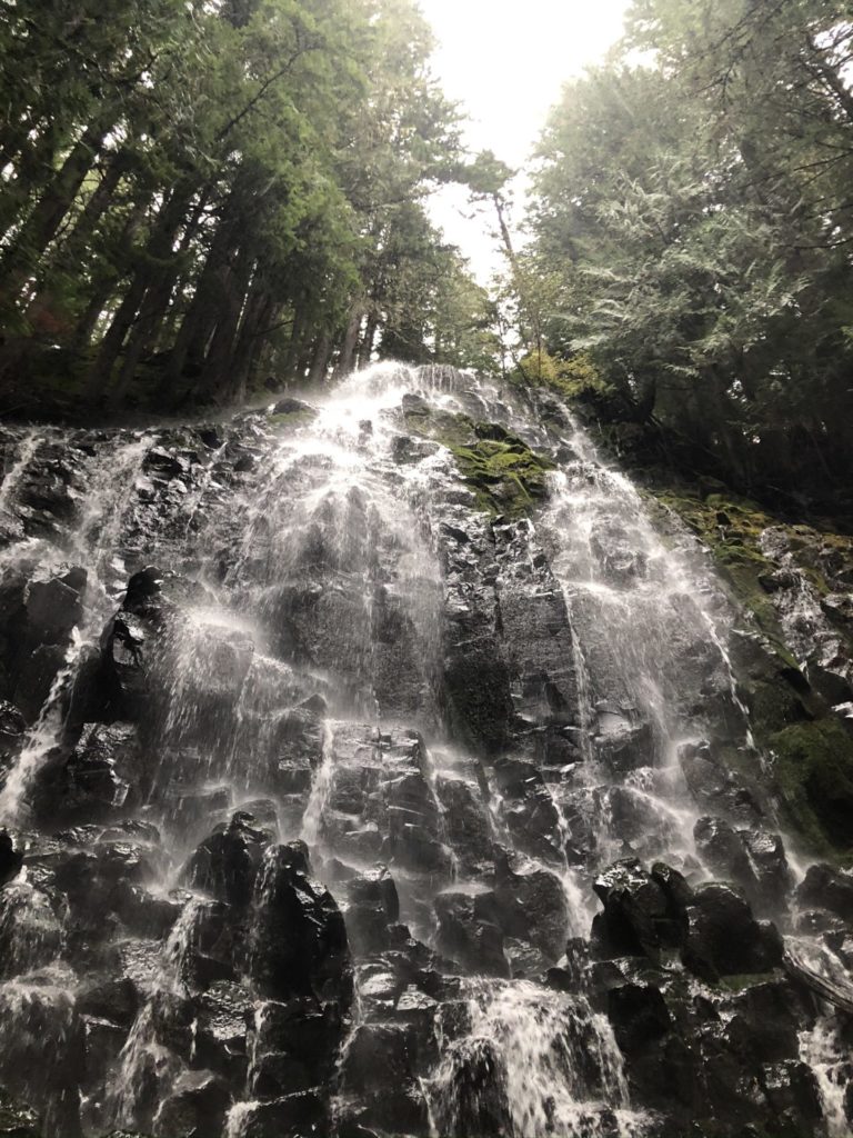
These pictures of the falls speak for themselves. Because I have “live” versions (and a few videos!) I have audio and I love to listen to them.
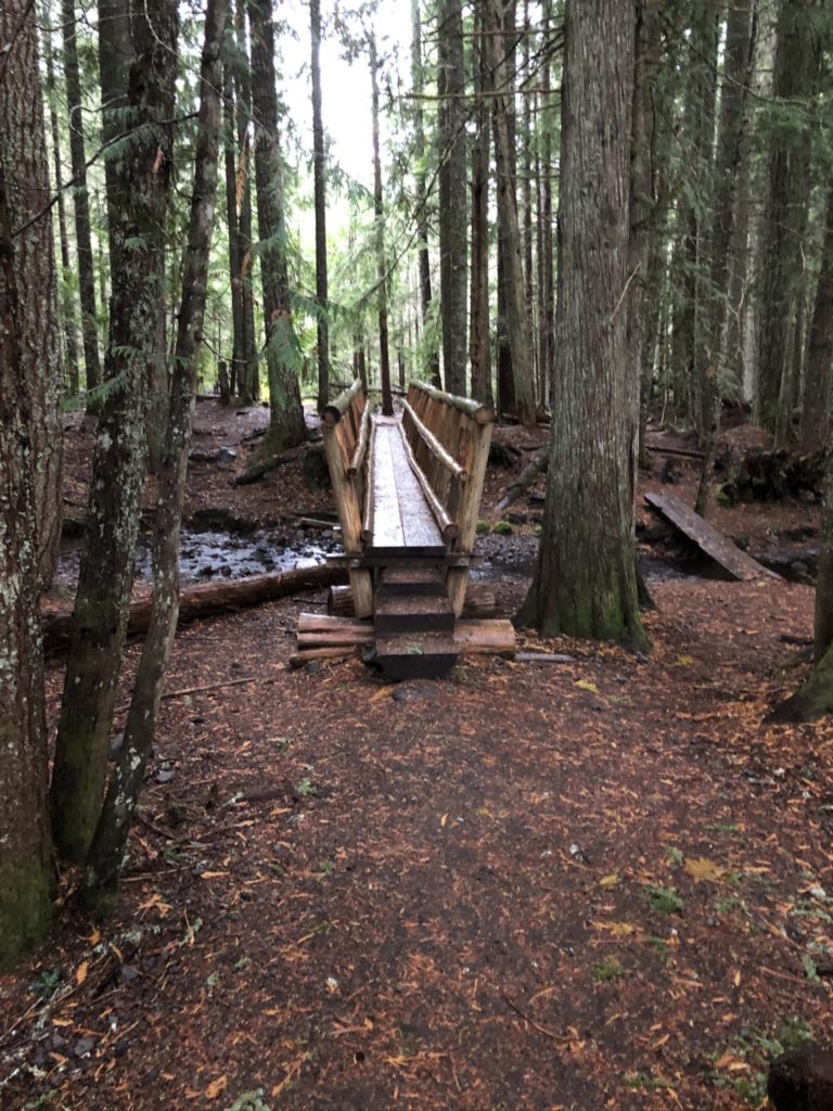
The loop section back has several very well constructed bridges (maybe that’s why no horses?).
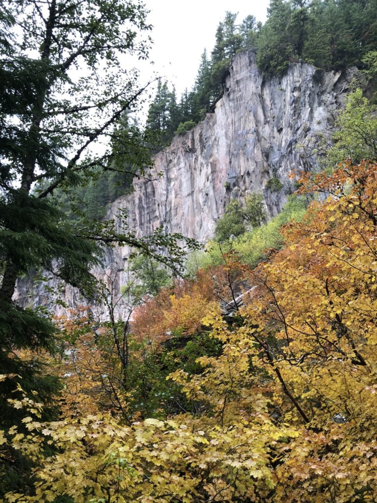
The loop section also has views of rock walls and more colorful foliage. This was mid-October.

Raven
Awesome
swiftfox
I’ve had wildlife positions in the eastern and western US. Western forests don’t have the diversity of birds compared to eastern forests and tend to be “quieter”.
Dan B
The huge boulder near the trailhead is probably a Glacial Erratic. In this area from the biggest floods in the geological record, the Missoula Floods that carried huge boulders from Montana and Idaho, and eastern Washington down the Columbia gorge. Yhis was probably in a hunk of glacial ice from the ice dam that created Lake Missoula. The chunk of ice stopped here as the flood receded. The glacial chunk melted leaving the boulder on top of the ground.
In Washington Srate the ice got as far south as Olympia si we’ve got these erratics that were on top of the tongue of ice itself – no need for an immense flood(s).
JeanneT
That picture tour was a beautiful start to my day. Thank you!
debbie
Stunning!
mvr
Thank you. The pictures really convey that grey fall Oregon feel. I know I’ve walked that trail at least a couple of times and I used to love the various hikes that start in the gorge and go up to some falls or other, or start at the bottom of one and go up from there.
I don’t live near there anymore and miss it.
ljt
Beautiful! Thank you.
susanna
Such a typical NW trail. I miss living there. Thanks for these pictures of its environs and the reminder of that smell.
svendson
Rock. Trees. Riverbed. Waterfall.
.. oh, sorry. I thought this was the Cognitive Test of Geniusitude.
WaterGirl
@svendson:
Thats only 4 words. I think that must mean you’re not a genius. :-)
Laura Too
Lovely, thank you!
Paul in St. Augustine
@svendson: I think you failed, you only got 4 out of the 5 words!
eclare
Very nice. Also interesting, nothing grows but trees?
mvr
@eclare: Ferns, moss, gooseberries,, blackberries . . .
frosty
How long was the trail? A day hike, you said? I have a Pac Northwest trip on my list.
Chagall Charles Caltrop
I love that part of the trail was gated off against horses …. otherwise, if there are a lot of horses on a trail, you spend the walk treading in what horses do to decorate the road. But I’m guessing the bridges are more likely the real reason why.
Lovely pics, lovely post!
williamC
That is for these! I’m definitely going to drive up there from Portland this fall and check it out! Still haven’t been up to Mt Hood!
JustRuss
Lovely falls, might take a day off later and hike that trail. Haven’t explored around Hood much.
feloniousferb
@frosty: Hey frosty, loved your pictures earlier this week.
You do not have to hike the “loop” section, you could do a straight out/back which might save some distance/time. I hiked the loop and it was 7.43 miles. It took me 2.5 hours.