On the Road is a weekday feature spotlighting reader photo submissions.
From the exotic to the familiar, whether you’re traveling or in your own backyard, we would love to see the world through your eyes.
frosty
Canyonlands: Southern Utah near Moab. We stayed at Dead Horse Point State Park.
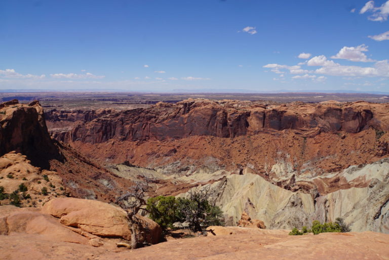
Not a big surprise, but this is a park with a lot of overlooks of canyons. It’s a park where if you want to get away from the main scenic drive to down into the canyons you’ll need a 4×4 … and not our Jeep Grand Cherokee. Something with some real clearance, off-road tires, and a spare tire lashed to the roof along with a couple of jerrycans and some water.
There are four sections to the park, Island in the Sky near Moab (which we went to), Needles, about 100 miles to the south, The Maze, which is only accessible by aforesaid 4x4s, and the rivers (Green and Colorado) with some Class V rapids inaccessible from land.
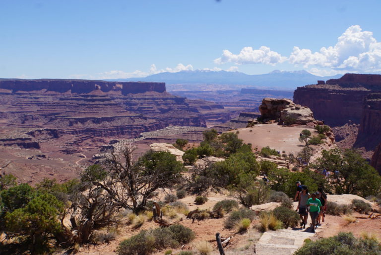
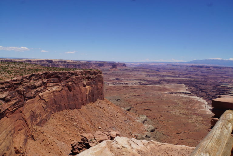
View from Shafer Canyon Overlook. La Sal mountains in the distance.
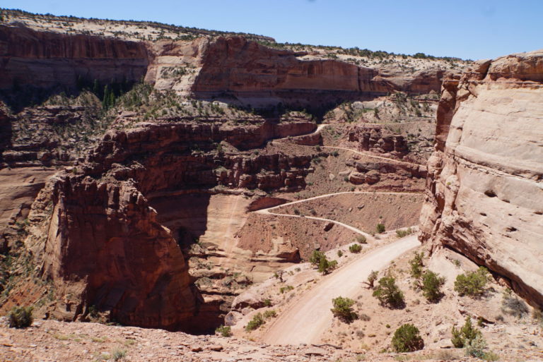
Shafer Trail “…mostly used by daring four-wheelers and energetic mountain bikers.” The mountain bikers we saw were heading uphill through the switchbacks, very slowly, going 1,400 feet from the main trail to the rim.
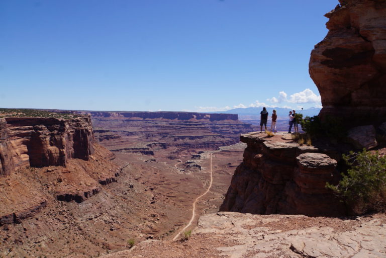
Crazy people at the Shafer Overlook taking selfies. My conclusion after reading “Death in the Grand Canyon” was that there are two main risk factors for falling off the rim: photography and testosterone…. we might have to add selfie sticks to the list.
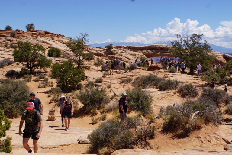
Mesa Arch. Don’t look for solitude communing with nature here. The trail to the arch is one of the most popular in the park. People line up to take their pictures under the arch.
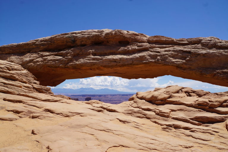
I waited until it was my turn, shooed a couple of people away and got a picture of the arch.
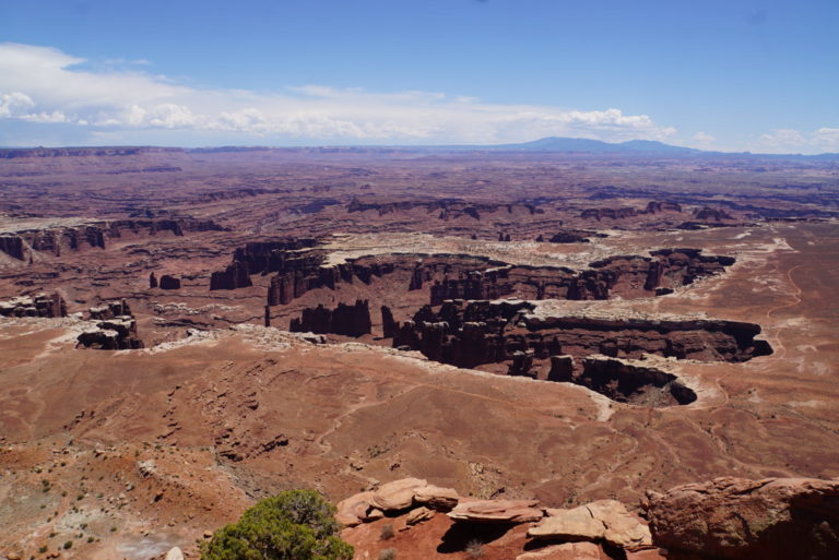
Grand View Point overlook. The plateau is White Rim Sandstone, a harder cap rock more resistant to erosion than the underlying rock.
Grand View Point overlook, looking back to Dead Horse Point in the distance. The view from the rim here was definitely grand, and impossible to do justice to with a photograph.
Upheaval Dome. This is the end of the trail to the first overlook. We were fortunate to meet up with hikers coming back from the more strenuous second overlook trail who told us the view wasn’t any better. The site is a circular depression two miles wide from either a meteorite strike or a collapsed salt dome. Even though no one has found extraterrestrial minerals, the meteorite theory is winning because of the deformation of the rock in the center.
Wag
Looks like you had an epic trip! Where to next? Looking forward to more photos tomorrow.
Benw
Really nice, Dead Horse Point is on my to go list!
Upheaval Dome: has no one considered supervillain lair?
Betty
What a country!
frosty
@Wag: Planning for the next trip is underway. Snowbirding in Georgia and Florida then Westbound to Northern California and Oregon. Looks like it’s working out to another five months on the road. I’m glad we like our trailer!
cope
At the risk of raising ire amongst the BJ faithful, when I was doing well site geology in the late ‘70s and early ‘80s, I was consultant geologist on several wells drilled in the Dead Horse Point and Upheaval Dome areas. The wells were technically challenging as the productive layers were buried amongst a sequence of more than 20 layers of pure salt. Once I had sat a well I the area, I established myself as knowing the geology and that got me several more wells in the region. This was good as I was self-employed.
These pictures are wonderful. I have been to all these places multiple times. I used to tell myself and anyone within hearing range that I was incredibly lucky to be working in places others came to on vacation. I’ve seen many ancient dwellings and buildings among the red rocks but this is the place where I found a granary while hiking during some down time time on a rig. I wasn’t on a trail or near a road, just bushwhacking on my own. This tiny little structure tucked up under a sandstone overhang was more awe inspiring to me than Chaco Canyon or Mesa Verde because I came upon it so unexpectedly.
Thanks for these pictures and a chance for me to reminisce on things I once did and places I once knew so well.
Wag
@cope: We all did things in our youth that we wouldn’t dream of doing again…
Roger Moore
Canyonlands is wonderful. You can avoid the people wanting to get their picture taken under Mesa arch if you get there for dawn photos, but you can’t avoid the photographers. The under side of the arch gets an intense red-orange glow from the sunrise light, and catching it is a classic photographic exercise. If you want to get those sunrise photos, you have to be at the arch hours early to claim a good spot. Even when I was there in November with snow on the ground, people would wait that long in the cold for the picture.
Also, the question of the origin of Upheaval Dome has been definitively answered: it’s an impact crater. They found shocked quartz- a mineral that is found only in craters from nuclear weapons and extraterrestrial impacts- there, which confirms it.
cope
@Wag: Truth. When I found the granary, I decided to climb up to it to see what might be in it. I had to friction climb some slick sandstone to get to it. No pots or points, just lots of old dried shit from creatures unknown. I was alone and hadn’t bothered to tell anyone at the rig where I was going so a fall could have been problematic.
the pollyanna from hell
I think I saw Island in the Sky from Needles, which is spectacular on a more human scale. As the crow flies shorter than hundred miles by road?
J R in WV
t looks to me that these Canyon Lands are kinda like Monument Valley, a Navajo Nation Park on the Utah/AZ border, only opposite. While Monument Valley goes straight up, the Canyon Lands go straight down.
StringOnAStick
@frosty: When you come through Oregon, I can show you some fun places in the central Cascades, and I’m sure Kelly from the other side of the pass would have some ideas for you. Put MacKenzie pass on your list, just south of Sisters, the Lava Trail interpretive walk (1/2 mile of fresh exotic basalt features) at the top is great.
Since I grew up in western CO and went to college there for my undergrad in geology, there were lots of winter and spring break trips to Canyonlands. 5 years ago we mountain biked that Shaefer trail, dropping in at the location in your photo and camping along the White Rim trail (we had a 4WD for the tents, food , and especially the water because there is none at any of the designated campsites) to the exit point climb out 5 days later. 12 and 14 years ago we mountain biked the San Juan Mountain Hut system route from Durango to Moab. (up and over the La Sal’s and into Moab) and the route from Telluride (up and out of there, then up and over the La Sal’s to Moab); hardest two things I’ve ever done since having a backup vehicle to carry your stuff will get you tossed off the route and no money refunded for the huts and food. It was so worth it though; great memories and thanks for reminding me!