On the Road is a weekday feature spotlighting reader photo submissions.
From the exotic to the familiar, whether you’re traveling or in your own backyard, we would love to see the world through your eyes.
frosty
Arches: Southern Utah near Moab. We stayed at Dead Horse Point State Park.
There are roughly 2,000 arches in the park. They’re like gators in Florida – they don’t count them unless they’re at least three feet wide (three feet long for gators). By a seat-of-the-pants count, we have about 1,975 to go to see all of them.
I expected to see arches, of course, but I didn’t expect to see so many interesting rock formations. One thing about the west – because of the limited rainfall, there’s not a lot of vegetation and forests to prevent you from seeing how the landscape was formed. It’s really easy to start learning about the deposition, uplifts, and faulting in the Colorado Plateau as you drive from park to park in Arizona and Utah.
We spent 1 1/2 days here. Our first attempt was Sunday on Memorial Day weekend. We got there at 9:30 to see a signboard saying “Park Is Full. Come back in 2 to 3 hours.” So we did some grocery shopping in Moab, headed back to the campsite, and toured the state park. On Memorial Day we went to Canyonlands, where we only had a half-hour wait at the entrance. The next day we got up early, got to Arches at 8:15 and waited a half hour. On our second visit we arrived at 4:00 with almost no line. My conclusion? The park info and guidebooks say get there early. I say, sleep late and get there around 2:30 or so after the early birds have cleared out. The line will be shorter and you’ll still have six hours of daylight in the summer.
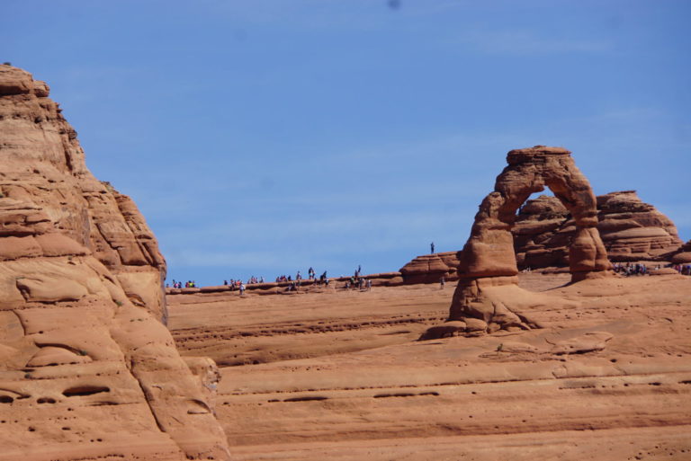
Delicate Arch, our first stop and one of the iconic arches in the park. There’s a short hike to the viewpoint where this picture was taken. There’s also a three mile round trip, three hour hike to the arch … on a trail with no shade and a narrow rock ledge for 200 yards. The people in the picture took the long hike and are waiting in line for selfies by the arch. This struck me as the same as Everest climbers – go on a bit of a hike (or an expedition) to get your picture taken at the destination. I’ve done it myself some times, but not here.
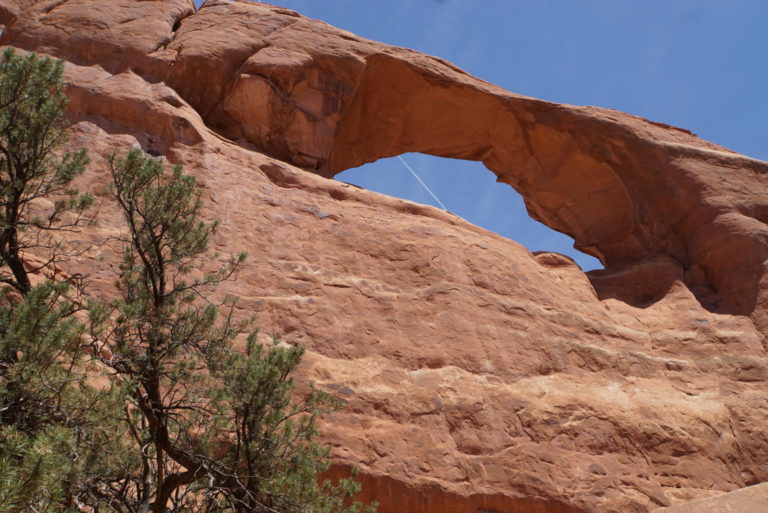
Skyline Arch from below. I thought the jet contrail ruining the perfect picture was a nice touch!
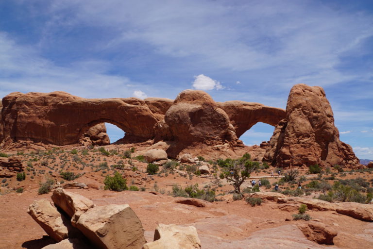
The Windows section has several short walks to arches. This is a pair of arches that share one support.
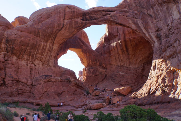
Double Arch, also in the Windows section. These are twin arches, one of which is the highest in the park.
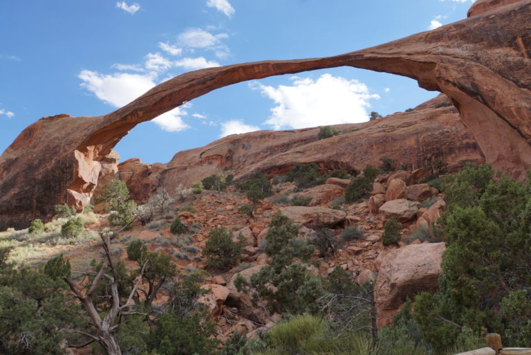
Landscape Arch, one of the other iconic arches. Reached after an easy 1.8 mile (round trip) walk. In 1991 a slab 60 ft long, 11 ft wide, and 4 ft thick fell from the underside. I doubt it will last another 30 years.
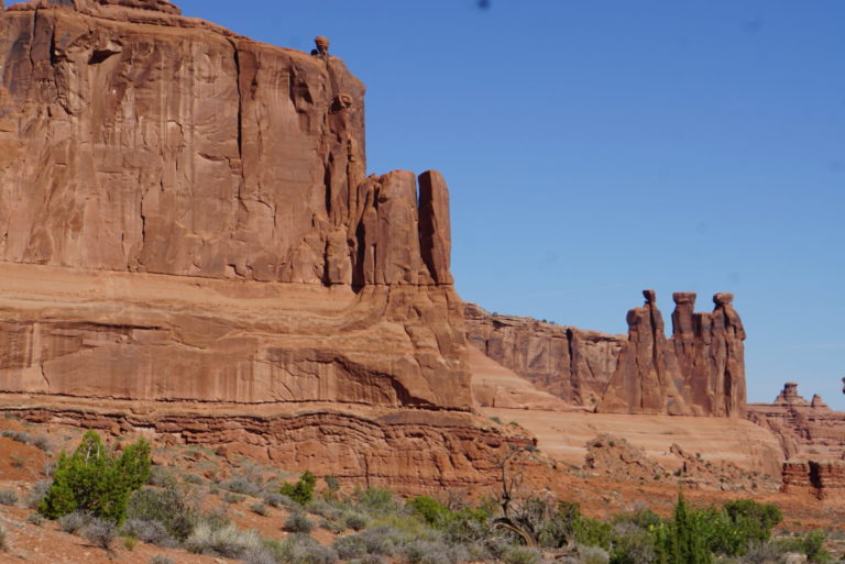
Near Courthouse Towers. The arches and the strangely eroded red rock are Entrada Sandstone, from windblown dunes, which is also the formation that eroded into odd shapes in Utah’s Goblin Valley State Park. The wavy formation at the base is the Dewey Bridge Formation, sedimentary deposits from tidal flats.
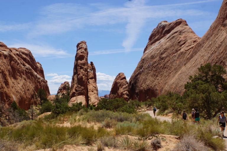
Fins at the trailhead to Landscape Arch. Fins are the precursors to arches, before wind and sand has eroded a gap.
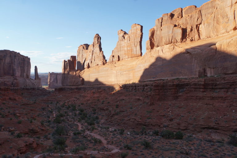
Park Avenue, named because of its resemblance to a street surrounded by skyscrapers. The fins are Entrada Sandstone.
sab
Delete for rewrite.
sab
After years of seeing the Utah license plate, my reaction to any mention of Arches was yawn. But these are amazing.
Being a freckled person, sunstruck parks don’t appeal to me, but these are amazing.
Your photos give a sense of the scope/ size of these arches.
YY_Sima Qian
Heh, I have almost identical pics! :-) Southern Utah is indeed a magical place.
Chris T.
By the way, you mention Goblin Valley State Park in the description. I really like that place: it’s a much smaller scale version of Weird Rock Formations, easier to get your mind around…
getsmartin
Gawd… love this region! We did Arches / Canyonlands / Deadhorse a couple of years ago during the winter. Crowds were very thin and the landscape had a nice snow dusting, which really enhanced the visuals. Also, when in the area, highly recommend driving highway 128 out of Moab to the east towards Castle Valley and Fisher Towers. The road parallels the Colorado River and there are some very rewarding and uncrowded hikes and visuals out there.
Wag
Again , great photos of one of my favorite regions. Can’t wait to go back.
cope
Thanks again for such evocative pictures of my old stomping grounds. It looks like you were pretty smart about timing your visits to the various arches, fins, towers, cliffs and outcrops so as to minimize dealing with so many people. Did you catch any of the petroglyphs in the area? There are lots of places where they are fairly accessible. There are also several places to see dinosaur tracks and even some in situ bones and fossils. It’s magical country out there for sure.
Tenar Arha
Great photos. I particularly like the one of the fins. It looks like a couple of them are singing.
frosty
@cope: We didn’t see any petroglyphs. We’ve seen them elsewhere (Petroglyph NM, a couple of AZ state parks) so it wasn’t a focus. As for fossils, our next stop after Arches was Dinosaur NM … I hope I posted pictures from there!
Xavier
You could pick a random spot in southern Utah and make an argument for why it should be a National Park or at least Monument.
Bill Dunlap
The best thing about the hike up to Delicate Arch is that you don’t see it in the distance as you approach. Yo turn that last corner on the trail and there it is in front of you. Dramatic.
J R in WV
Pretty much the whole south-west is magical as far as terrain goes. Once the bedrock is exposed, the weather turns it into amazing shapes, from the southern border all the way up north, anywhere it’s dry enough to expose the living bedrock. Volcanic cinder cones, hoodoos, arches, badlands, they’re everywhere you wander out there.
Hogback ridges, slot canyons, lots of it is pretty inaccessible — but lots of it is just a short drive on a bad road from anywhere. We love our mountains of WV, mostly covered with green trees and shrubs. Here, any exposed bedrock of any size was pretty much instantly made into a state or national park, it’s so rare. Out west, same thing, any substantially interesting rock formation, park, national forest, national monument, etc.
Once the plague winds down somewhat we hope to cruise around more parks out west. There are so many…
TriassicSands
When the monument was made a national park, the names of two arches were switched. Landscape Arch became Delicate Arch and the far more delicate arch became Landscape Arch.
Even if that story weren’t true, the names are misplaced given the settings and structures of the two arches. Delicate Arch isn’t that delicate and Landscape Arch isn’t situated in a truly dramatic landscape. But it certainly is delicate.