On the Road is a weekday feature spotlighting reader photo submissions.
From the exotic to the familiar, whether you’re traveling or in your own backyard, we would love to see the world through your eyes.
frosty
Despite having lived in Southern California for nine years, I had never been to Joshua Tree. We spent three days in the park. The first day we drove the Park Road, which passes by some of the most popular sites, as well as giving a good overall look at the park. We also stopped at every campground to see what we missed by not getting a reservation in the park. The second day we took the long trip to the south entrance at Cottonwood Springs, and on our third day we drove the Geology Trail.
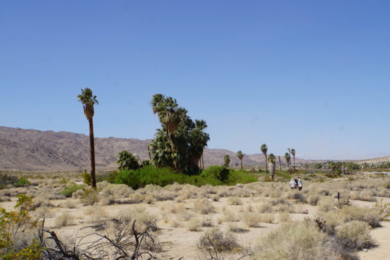
Oasis of Mara. This oasis is a very short walk from the North Visitor Center. It was formed from groundwater that found a way to the surface through faults in the rock. Over time, with development, the source dried up. The Park Service pipes water to it now to keep the original plants and wildlife going.
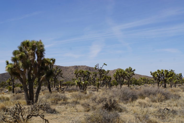
There are a lot of areas where the whole plain around you is covered in a forest of Joshua trees. I tried several times to get a picture, this is the best I could do.
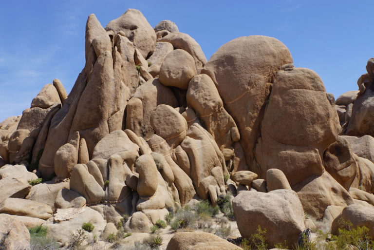
I expected to see Joshua Trees. I didn’t expect to see these rock formations, even though the guidebook said the park was a haven for rock climbers.
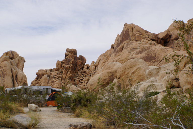
Indian Cove Campground. This is one of several campgrounds inside the park. All sites are reservation only, there are no hookups, and most are too small for any camper except the smallest popup or van. However, most of the sites are tucked up against the rocks just like these and look like great places for car camping with a tent.
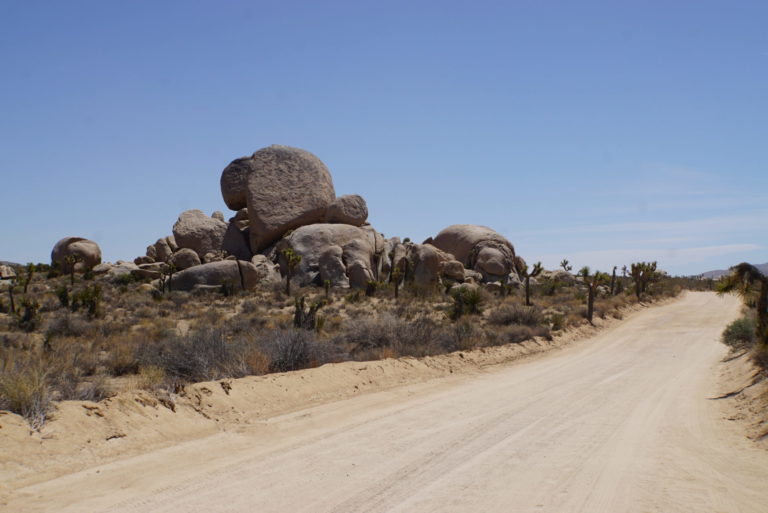
Geology Trail. The 16-mile Geology Trail is recommended for high clearance 4×4 vehicles, which is what we tow with. Between this and a few other unpaved roads we spent most of the day away from the crowds, feeling like we were part of the landscape. This is as close as I’m ever going to get to a back-country desert hike.
This type of rock is monzogranite, from magma that intruded around 85 million years ago, cooled below the surface, cracked to form joints, then weathered to these rounded boulders and rubble.
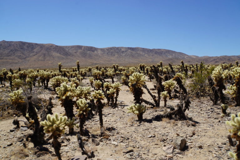
Cholla Cactus Garden. Another difficult picture; a photographer’s dilemma – once you put a frame around it you lose it. This is a field of cholla in every direction, just amazing to see. This is in the transition zone between the Mojave Desert (Joshua trees) and the lower Colorado Desert (Cholla, ocotillo).
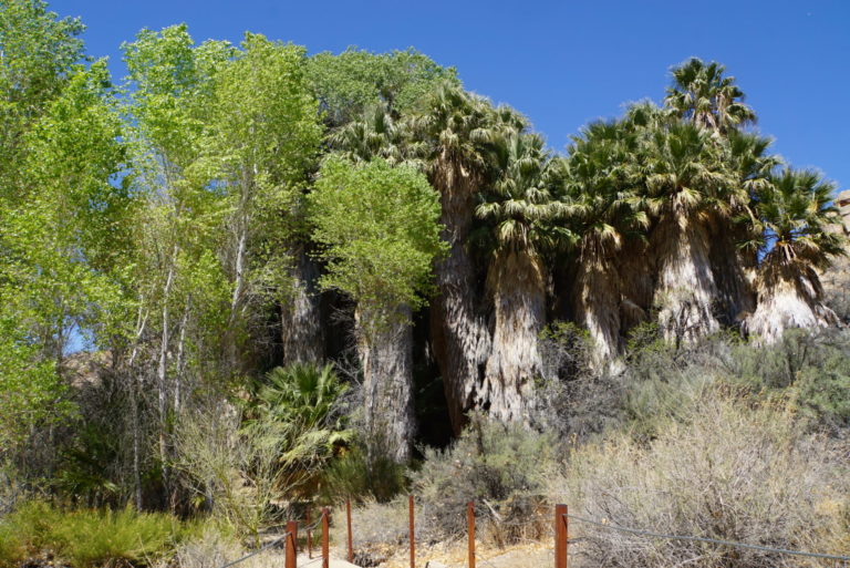
Cottonwood Springs. This is one of the Desert Fan Palm oases in the park.
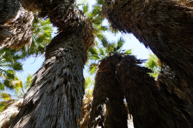
Looking up at the palms from inside the grove.

Quinerly
????
raven
nice
Cermet
Really nice pictures.
What you really mean by “with development, the source dried up.” Is humans drilled wells and sucked up all the available water so the oasis is dry now.
Laura Too
These are wonderful, thank you! I have made a habit of going back OTR right before bed every night to savor the pictures and also to read the stories people leave. I recommend it as has been good for my mental health and well being. I sleep better seeing the beauty of the world through BJ communities eyes and amazing stories people share.
Mary G
Joshua Tree has an aura you can’t catch in photos. Serious magical vibes. You and Bill come close, though. These bring back good memories, especially the rocks and the camping ground. It’s hard to score a spot there; I never did when I was young and after I got old and creaky, I went with motels in Desert Hot Springs. There was one with seven pools of mineral water, all different temperatures. I would just switch back and forth and could hear my joints going ah…
?BillinGlendaleCA
Nice shots Frosty, nice to see some parts of the park I’ve not seen.
frosty
@Cermet: Yes, that’s one issue for development drying up the source. Another, probably less important here, is paving the watershed so that precipitation runs off instead of infiltrating to the groundwater.
frosty
@?BillinGlendaleCA: Thanks Billin! I appreciate the compliment, with all your JT pictures and familiarity with the park. Cutting everything I shot down to eight pictures was really tough.
Dmbeaster
Been going there regularly for five decades. Spectacular spring wildflowers in wet years. My father loved it, and we gave him an April tour in a good flower year three weeks before his death from cancer. Scattered his ashes there later in Queen Valley below Queen Mtn which he loved to walk up.
One of my favorite hikes is the cross-country hike from Barker Dam to Indian Cove through the heart of the Wonderland of Rocks. Its 5 miles but takes 5 hours plus because large sections are various degrees of rock scrambling, including some class 3 climbing as you drop into Rattlesnake Canyon near to Indian Cove. Simply walking a mile up Rattlesnake Canyon from Indian Cove is a good walk – no trail, but not hard.
A full moon walk anywhere around Hidden Valley is amazing.
Learned basic rock climbing in Indian Cove as a 17 year old taking the Sierra Club’s Basic Mountaineering Training Course.
There are great Joshua Tree forests in many places – particularly notable is the Wee Thump Wilderness in Southern Nevada which is small (6000+ acres) and bounded by roads, so very accessible. https://commons.m.wikimedia.org/wiki/File:Wee_Thump_Joshua_Tree_Wilderness_2.jpg Its along the road from the Nipton exit on I-15 just short of the Nevada border, and heads through Nipton to Searchlight – Harry Reid’s little home town.
?BillinGlendaleCA
@frosty: Heh, as I told you before you were heading out, it’s a big place. I’d never been to the south end of the park(and I didn’t stop a whole lot, just drove though) until last month.
J R in WV
Great photos of a mysterious place, thanks.
Have come to love visiting the deserts in the SW…