On the Road is a weekday feature spotlighting reader photo submissions.
From the exotic to the familiar, whether you’re traveling or in your own backyard, we would love to see the world through your eyes.
Kabecoo
This is the second post about the Skyline trail in Olympic National Park. The first two days of hiking brought me to an area I had not seen in several years. I was looking forward to a day with many flowers, a bear or two if lucky, maybe some new blisters!
One small wrinkle: the trail varies from its location as shown on several topographical maps. Most of these variations are minor, but sometimes the maps are off by a thousand vertical feet or so. This had gotten me into trouble a few times before and I was hopeful about staying on route.
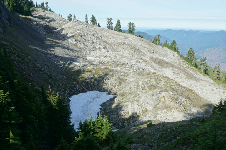
I tried to get started as early as possible the third day. Once on the trail I took this photo of last night’s basin, my campsite just to the right of the large snowfield. I remembered taking this same photo in 1986 because a bear was napping on the snow. Thirty-seven years later he was nowhere to be seen!
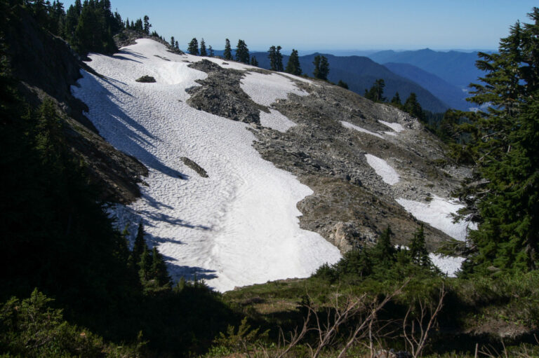
But the most dramatic difference in snow is from September 2012. I had no need to camp down there back then as there was ample water available everywhere.
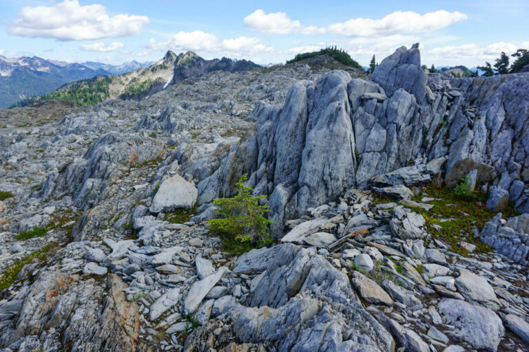
After Kimta basin the route climbs to Promise Creek pass, leading to a rocky, confusing section sometimes called the moonscape. It begins on the north side of the pass, where snow melts slowly and many small drainages draw the attention of larger animals seeking refreshment. However, this year there was almost no snow and the numerous drainages were dry or boggy.
A small fir trying to get established caught my eye. It likely won’t last, as the surrounding terrain shows.
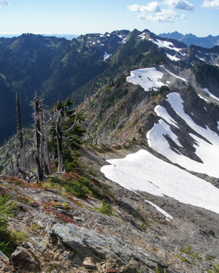
At the southern end of the moonscape, High Camp sits above the trail at a point where two ridges meet. From there a hiker can admire the changing environment as the ridgeline separating the moonscape from Kimta basin shows how different an area can be, based in part on whether it faces north or south. Looking west, the ridgeline shows heavy growth and greenery on the south (left) side, with snow and bare rock on the north.
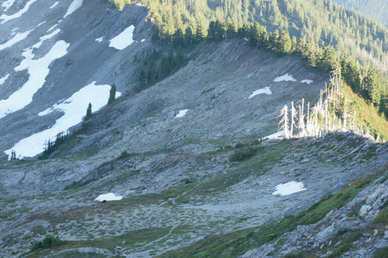
Same thing, just looking east in 2012. Lots of growth (and white tree trunks from a 1987 fire) on the south (right) side, lots of rock and snow on the north.
And a bear, next to a small patch of snow. I got too close to that bear the following morning. (At least it sure looked like the same bear!) We both chose the same melting snowfield to draw water from. In my defense I was there first and he never should have snuck up on me if he didn’t want to hear me yelp
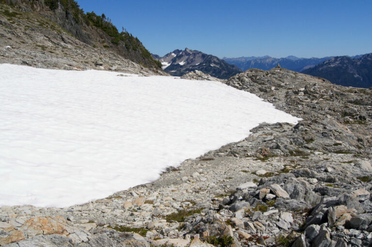
In 1986 we made it safely through this section due to the cairns. In this 2012 photo a snowfield had melted just enough to expose a bit of a path, while a single cairn stands ready to assist the wandering traveler.
The top half of Mt. Seattle can be seen in the distance. The trail will eventually reach its splendid meadows.
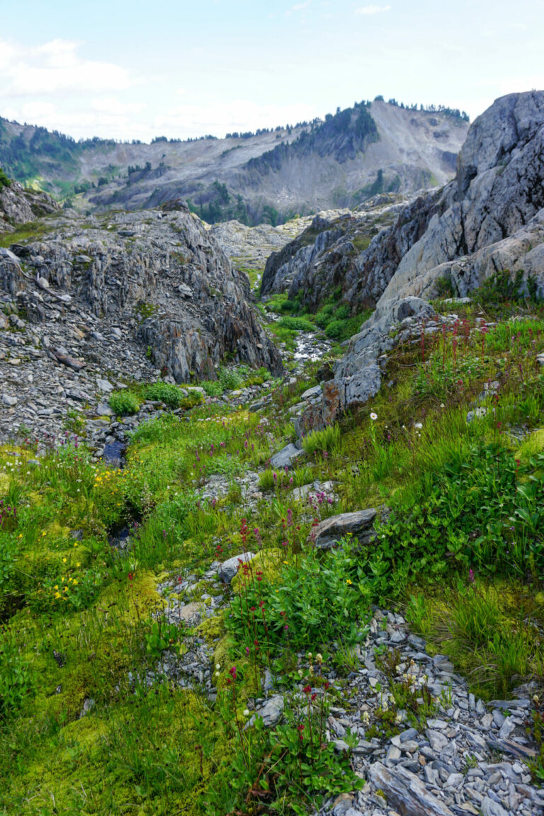
After a few miles the rocks give way to a series of basins, each unique. Many were still green and lush, most had small boggy areas, but water remained elusive. I dawdled, looking around for surface water. With so little water easily found, the remaining drainages with flowing water were also more popular with larger animals, shown by the hoof prints around.
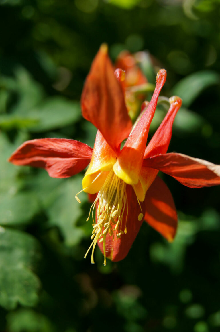
Columbine, tiger lilies, asters, shooting stars, lupine, heather, paintbrush… the right micro-environments support thousands of blooms beginning as soon as the snow melts and lasting until mid-September. Avalanche and glacier lilies begin the show, with others taking over as the weather warms. Fireweed seems to last the longest with its sequential blooms. It is a popular flower for beekeepers in lower elevations.
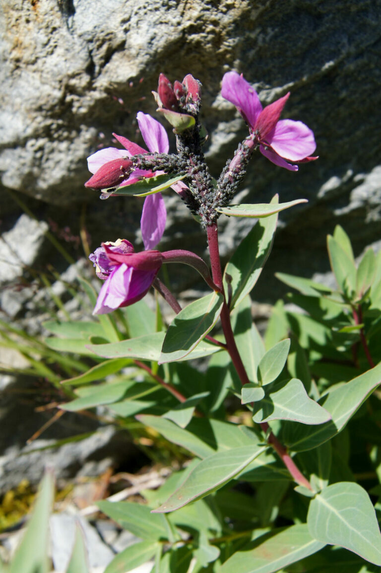
This is a broad leaf fireweed carrying an interesting pest: aphids. These were being farmed by ants. Aphids provide sugar-rich honeydew for the ants; ants protect and defend aphids.
Our son told us about this arrangement about 10 years ago. I had likely walked right past hundreds of examples over the years, now I try to stop and watch.
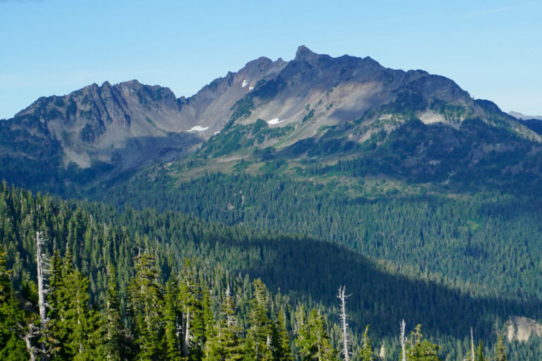
The trail takes the hiker between Mt. Seattle (above) and Mt. Zindorf (first pic on Post #1). Seattle occupies the views ahead, northernly; Zindorf sits to the east. The source of “Zindorf” is unknown.
Mt. Zindorf was named by a member of the Press Expedition, an effort funded by the local newspaper. The five man group crossed the Olympic Mountains in the winter of 1889-90, moving their supplies first by a boat they built and tried to drag upriver through the Elwha River drainage on the north side of the park. Boatless, they eventually reached to a pass leading them to the Quinault River. Many interior mountains, creeks and campsites were named by the Press Expedition, others by Army explorations the following summer. The expedition kept extensive diaries but none provides any background for Zindorf.
Several mountains were named for various newspaper editors and owners across the country, many of whom – except Pulitzer – are forgotten. Campsite names were often more descriptive: Two Bear camp, Pleasant, Nine Mile. Three Prune Camp describes a dinner in 1890 when the food train didn’t arrive to feed the workers breaking trail.
Getting around Mt. Seattle takes much of a day, mostly because its meadows are so enticing. Flowers, streams (usually), accessible areas to explore….

There go two miscreants
Zindorf was Gandalf’s ne’er-do-well older brother.
Nice pics in both posts.
!
OzarkHillbilly
Wonderful, Kabecoo, thanx much.
JeanneT
Your narration makes the photos even better. Nice hike!
Trivia Man
I especially like seeing them and now sets
mvr
Thanks for these! Predictably I like the photo of where you get some water again with all the vegetation. Lack of water makes me nervous.
Kabecoo
@mvr: Finding water dominated each day until I got down to lower elevations. I often left the route looking for water, one reason the hike took so long. I was never totally dry, but came close a few times. Wound up drinking from sources I would usually avoid!
StringOnAStick
@Kabecoo: I think I remember that WA had a less than normal snowpack this year, and your photos show the results of that. Those upper areas are so rocky and have little soil or vegetation to slow the passage of melt water.
Lovely photos! This area is officially on our list for next hiking season.
Dan B
@StringOnAStick: We had a great snowpack but it got warm early and melted. We’re having a warm October like the rest of the “left” coast. Seattle is short of water even though we’ve had some deluges recently. There’s no snow in the river basins that supply the metro area.