On the Road is a weekday feature spotlighting reader photo submissions.
From the exotic to the familiar, whether you’re traveling or in your own backyard, we would love to see the world through your eyes.
I am surprised (and delighted) by the enthusiastic response to the pictures from this trip. I guess that it is due to seeing pictures from a place that is so off the beaten track for one. Second, everybody knows of the Sinai from the Bible and probably has an image in their head of the Sinai being like the Sahara, an endless expanse of sand (I don’t know whether this is true for the Sahara as a matter of fact). Some readers of the earlier parts expressed something like “I had no idea the Sinai was like that” when they saw that the Sinai is not like the Sahara.
I will conclude this series with another set of pictures of the landscape we walked through, less focussed on geological features as Pts 2 & 3 were and more illustrative of larger scale features of the landscape.
And then it is about time to get ready for this year’s hiking season which for me will start in early April and will likely end in November if my old bones hold up to what’s on the agenda.
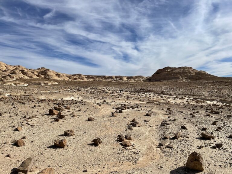
Jebel El Gunna is a long-stretched mountain of about 1500 feet height that has only a few points where it can be accessed by climbing a moraine. here we are looking back over the system of wadis we walked that day to get to the base of one of these access points. It was a particularly desolate area, we encountered vegetation in only one wadi where the Bedouin had built a dam to collect rain water and used it to irrigate an orchard.
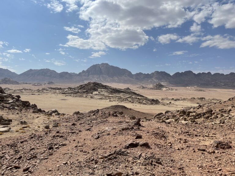
This is a look back from the ascent to the hydrothermal vent I had shown a picture of in Part 3. We had walked over sand for a couple of days and now were climbing up to get to the “volcano”.
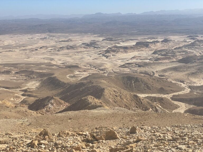
A view from the top of Jebel el Gunna on the system of washers and wadis below
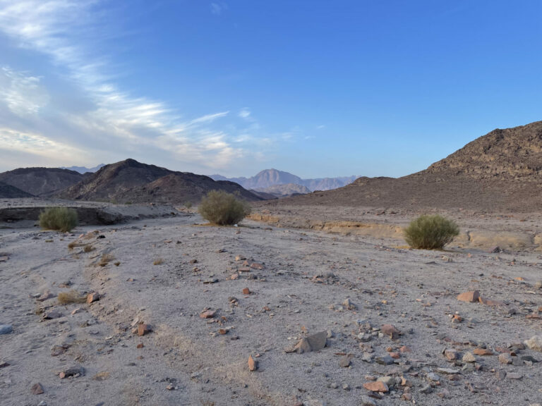
No fewer than three plants in the frame! Notice that they all grow in the wash rather than on higher slopes. These are ratam bushes which are deeply rooted so they can hang on when a flash flood rages through the wash. Any rainfall will immediately lead to a flash flood as there is hardly any top soil on the slopes that is able to retain some of the water the way most of us are used to.
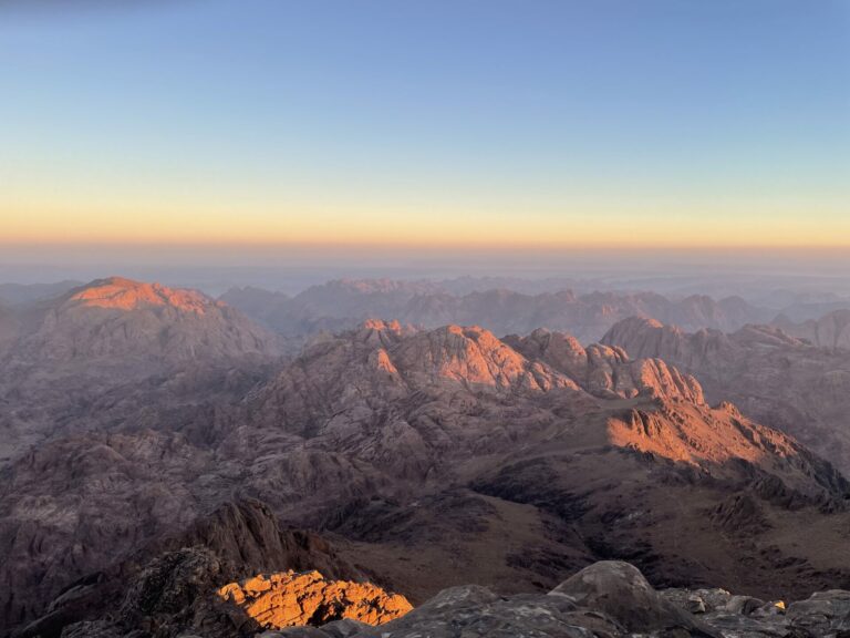
Sunrise on Mount Katherine, the highest peak in Egypt.
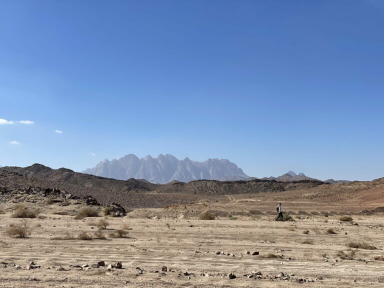
The Sinai trail, as originally devised, was running along wadi Feiran below Mt. Serval shown here in the background. A few years ago the local tribe and the police got into it, people, Bedouin and police, got killed and the area is off limits now. Who knows if, how, and when this will get resolved. It is really too bad, this looks like a pretty rough but inviting climb. If it were opened up again, I might go back to just do Section 3 again. But tempus fugit and I don’t know how many more years I can do trips like this. So I encourage the tribe and the police to get their shit sorted out!
I had mentioned earlier how hard it is to walk in sandy wadis where cars are driving as they churn up the sand which makes it very tiring to walk in the tracks. Here you see my friend walking on sand that has not been churned up, close to the shrubs< in order to walk more easily. The micro-orientation task then is to find another stretch of non-churned sand that one can transfer onto once the stretch one is on runs out.
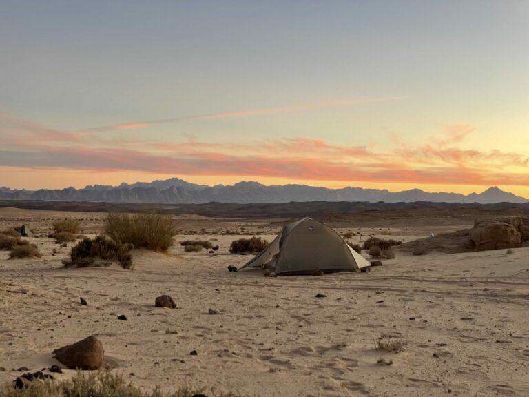
View of the St. Katherine area in the distance. The picture is taken from the northerly route from Serabit El Khadem back to Nueiba.
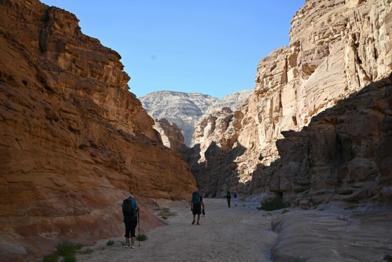
Hiking in a slot canyon as we make our way through the coastal range into the wadis beyond.
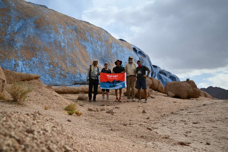
Years after the Israel-Egypt Peace accord of Camp David the Israelis returned the Sinai to Egypt. There was an artist who wanted to memorialize this historic occasion by painting this valley blue. The Israelis did not want to have anything to do with him, but Sadat apparently said “Sure, go ahead”. So these rocks got coated with blue paint.
Of course, the sheen has come off of this installation, as it has come off the Israel-Egypt peace accord, which has not been the nucleus of agreements with other Arab governments as once was hoped, I think.
The paint is peeling off the rock as erosion by blowing sand creates holes in the coat.
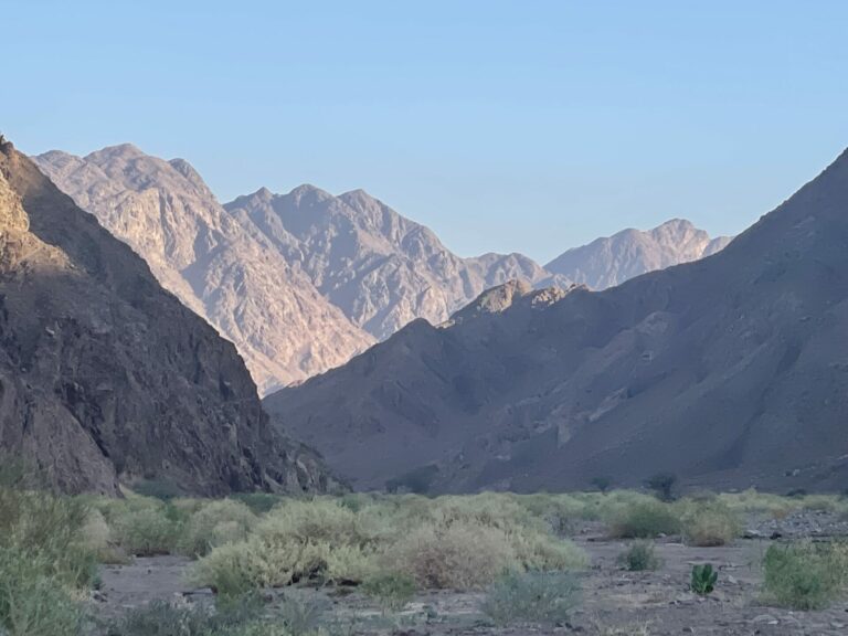
Installment 6 of the Sinai Trail On the Road had few images containing signs of plant life.
For the last image then a picture taken in one of the greenest wadis we ever saw, just to show that the scenery is not all barren, even if admittedly mostly barren.

HinTN
Sadat’s assassination changed everything.
This has been a wonderful look at and vicarious visit to a land I had not imagined looked at all the way it does. Thank you!
OzarkHillbilly
Thanx for everything TKH. The narrative as well as the pics.
Betty
Quite the adventure. Thanks for the extensive tour.
vigilhorn
Did you find any tablets with more commandments on them?
Doug
Thanks for the photos!
The Sinai and the monastery at St Katherine’s play an important role in Dorothy Dunnett’s great Niccolo novels. It’s neat to get to see what the area is like today.
In this set, your picture of Mt Serval is especially gorgeous. The one of the slot canyon made me hear Obi-Wan Kenobi’s voice talking about walking single file.
Paul in Jacksonville
You have piqued my interest as to where your hiking expeditions will take you this year.
Anyway
@Paul in Jacksonville:
Yes! This is an epic adventure and enjoyed the highlights and observations.
TKH
@Paul in Jacksonville: Nothing as unusual as Sinai. Not easy to encore.
I’ll be crossing Arizona into NM on the Mogollon Rim “trail”. Then I’ll be going to Corsica for a second go at the GR 20, which defeated me last year when the gendarmery kicked everybody off who did not have crampons and ice axe. Then I’ll be going to the Sierra Nevada to acclimatize for two long hikes in Peru. After that I have to see the state of my cartilage ;). Either the Olympics or the Butte Fault route in the Grand Canyon. After that: The Couch!
Layer8Problem
Thanks for sharing this adventure!
eclare
Fascinating photos, thanks!
stinger
Love all these!
The photo of Mount St. Katherine appears to be taken from above. How is that possible?
TKH
@stinger: The photo was taken right next to the chapel on the summit. The mountains you see illuminated by the morning sun are neighboring peaks and lower-lying false summits of Mt. Katherine, which is quite a massive chunk of rock.
pieceofpeace
By the last photo, I was exhausted, imagining the arduous walking of that terrain. Bleak, and beauty, the slot canyon and your eye for light/shadow interplays became more with your narrative. Thank you.
cope
This has been a wonderful series, thank you. Your planned treks sound wonderfully spectacular as well. I hope we get to see pics from some of these in the future. You write well and reading your accounts reminds me of reading Colin Fletcher’s books way back in the day.
Thanks again and happy trails to you.
way2blue
TKH—love your whole Sinai photo series. My favorite today is the slot canyon. Such harsh landscapes, even the relatively lush wadis. N.B., per your first photo—not a moraine unless the Sinai had glaciers in its recent past. Scree slope perhaps?
Manyakitty
Fantastic. Thanks again for sharing!
Paul in Jacksonville
@TKH: Not many people are able to circle the globe and do those things you do. I’m a bit envious, truth be told. I’m sure some of the other jackals here would enjoy your future postings. Safe travels!