?BillinGlendaleCA
Jepp and Tom Ryan homesteaded in the Lost Horse Valley in 1896 near a spring and the Lost Horse Mine. The spring provided water to the mine, 3 miles away. The Ryans built an adobe house and quite a few outbuildings.
After the gold boom died out in the early 1900’s, a number of folk tried their hand a cattle ranching at Joshua Tree and surprisingly didn’t do well. There’s not much left of the ranch house, just the slab and some walls primarily due to a fire in 1977 and vandalism.
It’s a short walk from the Ryan Campground, but there was no parking there, so I ended up hiking from the trailhead on Park Blvd (the road that runs though the northwestern portion of the park). The trail starts off with sand but the ground firms up pretty well after that.
The longer trail passed some really nice rock formations which even inspired a rare B/W infrared treatment. At one point it looks like Joshua Trees were planted in a row leading up to that formation. Most of the photos (7/12) were shot with the IR camera using the IRChrome filter. I’ve interspersed the visual shots amongst the IR shots (they’re the ones with green Joshua Trees).
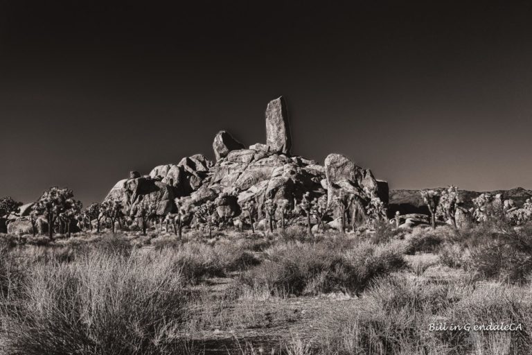
Black and White infrared view of this interesting rock formation along the trail.
On The Road – ?BillinGlendaleCA – Ryan RanchPost + Comments (21)