Baxley GA
Not sure.
![]()
Come for the politics, stay for the snark.
Not sure.
Fern Canyon is very different part of the park, in that the main focus isn’t redwood forests. It’s a 50-foot canyon covered with sword, deer, and five-finger ferns. Access is on an unpaved road with a couple of stream crossings, and the walk itself included wading upstream.
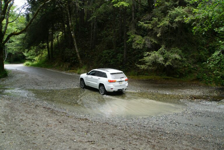
Crossing the stream
All the National Parks we’ve seen have been unique. This one, of course, because of the redwood groves that have been preserved. Also because it is a combination of the National Park and three California State Parks, all contiguous and all preserving old growth forest. This also means that it’s a park with no entrance fees because the roads cross all the parks and it would be unmanageable.
This post has pictures from two groves and scenic drives adjacent to them: Stout Grove (Howland Hill Road) and Lady Bird Johnson Grove (Bald Hills Road).
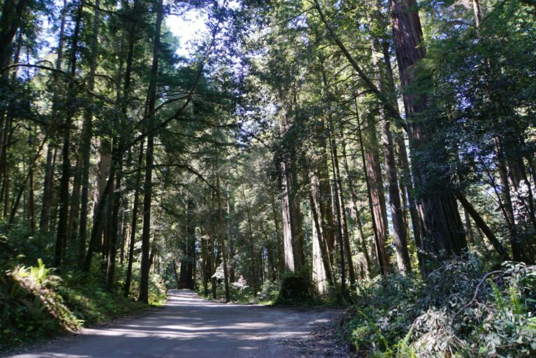
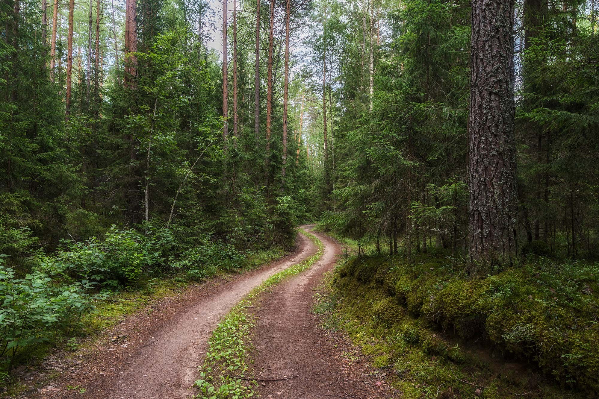
Howland Hill Road. This is a 10-mile unpaved road through old growth redwood forests.
We’re traveling all over this week; it should be fun!
If you’ve been thinking of submitting some pictures, now would be a great time to do it. We’re filled up next week, but wide open after that, so this is your chance to have your stuff show up within a week or two.
(click on the schedule below for a bigger, non-blurry version)
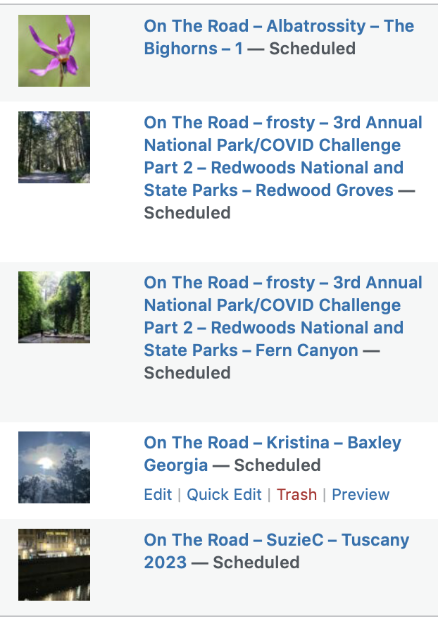
Today’s excursion started back in 2007, with a trip to the Bighorn Medicine Wheel on Medicine Mountain in Wyoming. Elizabeth was researching an essay for her next book, and I was, per usual, along for the ride. We wanted to see the summer solstice sunrise at the site of the Medicine Wheel, so we headed up there in June 2007. Her essay about this experience, entitled “Geochronicity”, appears in Horizon’s Lens: My Time on the Turning World; a shorter version of that essay was also published in Orion in 2008, and is available online. If you want some background about the site and its history, I’d suggest reading the essay before proceeding. Her words illuminate and magnify the experience far better than mine, but I can at least offer some photographs and my own perspective.
Exactly 8 years later we found ourselves in the Bighorns again, enroute to a literary conference in Moscow, Idaho. So this will be a two part experience; today’s and next week’s posts about the 2007 trip, and then several posts about the second visit, as part of a longer road trip travelogue. I hope you enjoy it as much as I have enjoyed going back through the images, processing them with more modern software tools, and re-living those experiences anew.
As noted in Elizabeth’s essay, we explored the site (accessible via a 1.5 mi trail from a parking area to the 10,000 ft summit), and then camped nearby. It was a lovely streamside campsite, with lots of wildflowers; at this altitude, late June was basically springtime. Thus these first two posts will have lots of flower images and only a few birds. But one of the birds was this Golden Eagle (Aquila chrysaetos), the iconic raptor of the West, soaring over the Medicine Wheel when we arrived there. This bird would have been very familiar to the folks who constructed this ceremonial site on the mountaintop. Click here for larger image.
On The Road – Albatrossity – The Bighorns – 1Post + Comments (14)
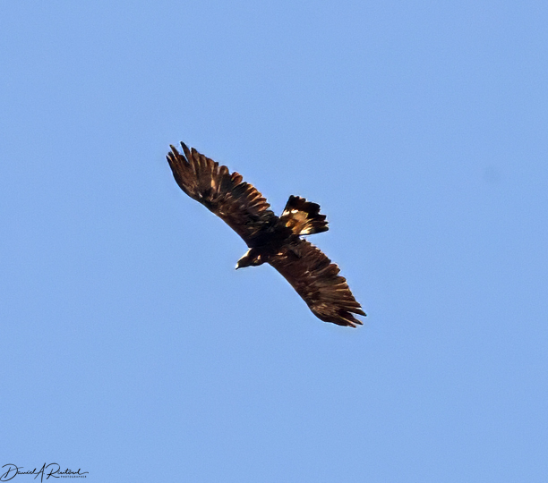
This park was formerly named Patrick’s Point, but has been renamed for a Native American village used by the Yurok tribe. Sumeg village has been reconstructed in the park and is used by the Yuroks on ceremonial occasions. This was our base for seeing the Redwoods, but while we were here we took a couple of walks around the park and saw the sights and the overlooks. The first was Agate Beach, where our campsite was located. The second was Wedding Rock and the area around it.
Reconstructed Sumeg village
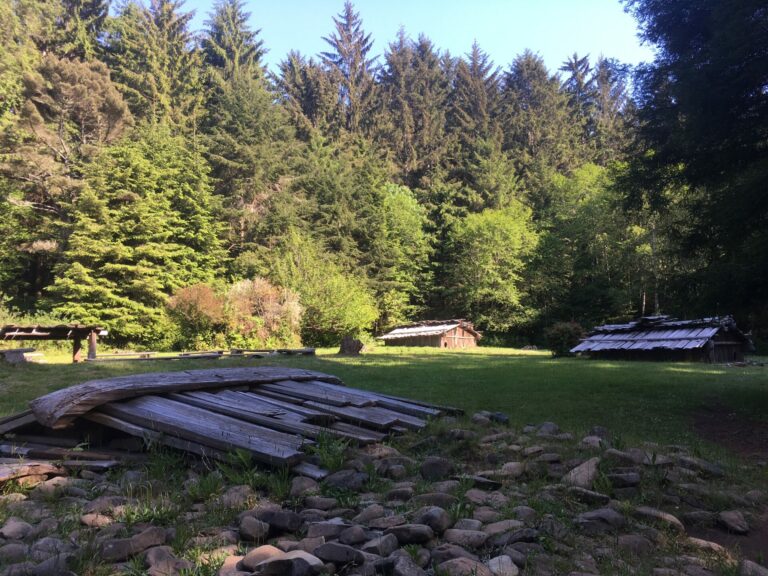
Here’s another visit where our travel schedule didn’t fit the National Park schedule. The scenic park road goes from 6,700 ft to 8,500 ft elevation and the park gets up to 30 ft of snow, so the road usually doesn’t open for traffic until June. There’s a loophole, though. Anything that’s plowed and passable is open to hikers and bikes. So we unloaded our eBikes and headed up (1,800 ft climb) for about eight miles.
Once we got past the first mile from the Visitor Center we only saw half a dozen hikers and five other bikes. And to be honest, even if we’d been there in summer we might not have done the visit much differently. Other than one nature trail there weren’t any hikes that we were prepared to tackle. So a traffic-free ride at our own pace was just as good or better.
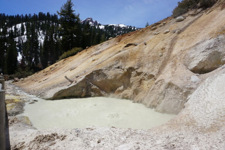
Sulphur Works. Fumaroles, mudpots, and boiling springs, driven by groundwater heated by magma. This picture is one of the mudpots.
I am surprised (and delighted) by the enthusiastic response to the pictures from this trip. I guess that it is due to seeing pictures from a place that is so off the beaten track for one. Second, everybody knows of the Sinai from the Bible and probably has an image in their head of the Sinai being like the Sahara, an endless expanse of sand (I don’t know whether this is true for the Sahara as a matter of fact). Some readers of the earlier parts expressed something like “I had no idea the Sinai was like that” when they saw that the Sinai is not like the Sahara.
I will conclude this series with another set of pictures of the landscape we walked through, less focussed on geological features as Pts 2 & 3 were and more illustrative of larger scale features of the landscape.
And then it is about time to get ready for this year’s hiking season which for me will start in early April and will likely end in November if my old bones hold up to what’s on the agenda.
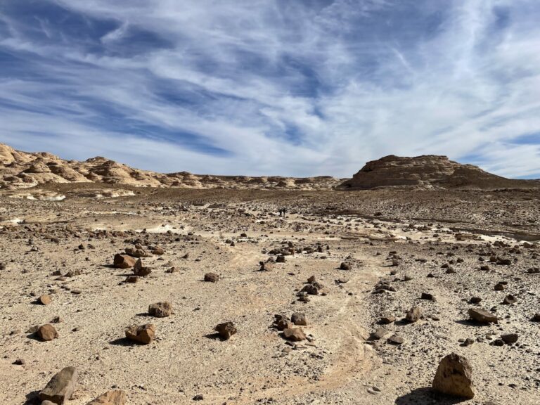
Jebel El Gunna is a long-stretched mountain of about 1500 feet height that has only a few points where it can be accessed by climbing a moraine. here we are looking back over the system of wadis we walked that day to get to the base of one of these access points. It was a particularly desolate area, we encountered vegetation in only one wadi where the Bedouin had built a dam to collect rain water and used it to irrigate an orchard.