TKH
The Paria river is a tributary of the Colorado River. It drains an absolutely huge area of the Grand staircase Escalante National Monument (GDSENM). In its lower reaches it runs through a slot canyon that starts some 40 miles west of Kanab, UT and ends at Lee’s Ferry. Some miles down the slot canyon is the confluence with Buckskin Gulch, the World’s longest slot canyon, of which I have shown some picture here in a previous submission.
During my latest crossing of Southern Utah I hiked the Paria slot and then climbed out to the top of the Paria Plateau. I crossed the plateau, then climbed down by the Vermillion Cliffs and hiked over to the Grand Canyon.
I this submission to One the Road I show you some pictures from the Paria Plateau. There are two special areas on the plateau, the Coyote Buttes, to which access is strictly controlled. One is the famous “Wave” located in Coyote Buttes North and the other is the the Coyote Buttes South area. In order to visit either of these sites you have to have a permit which you obtain (or not, most likely) by participating in a lottery, either online via recreation.gov or locally two days before you hike. There are a maximum of twenty lucky people per day that get to visit these two places. There are of course always a few who try to sneak in and they invariably run afoul of the rangers who patrol these areas every day. I am told that it is expensive when you get caught. I have so far not been lucky enough to score a permit, but this Fall I scored an overnight permit for the Paria Canyon, so I know that one can and even I can be lucky.
This Fall I visited the White Pocket as part of a short two-day hike, passing Coyote Buttes South as I did so, getting a sneak preview of what the might be like. I will include a few pictures of what I saw in this submission. White Pocket is accessible from a trailhead along a long and rather rough dirt road. A hike of about five to six hours will get you there. It is not that far, but the entire hike is along deeply sandy roads and walking these is just exhausting. Those who cannot or do not want to put in that much effort can drive to White Pocket if they have a 4 WD car and if that vehicle has high clearance and if they know what they are doing driving 4 WD. Getting stuck up there and having to be pulled out would be really expensive.
My plan was to reach White Pocket in early afternoon, take some pictures in late afternoon, camp nearby, take some more pictures early in the morning and then return to my car. As a consequence of how White Pocket is situated the light in late afternoon was not good for taking pictures, most of the sandstone was in the shade.
On The Road – TKH – The Paria PlateauPost + Comments (20)
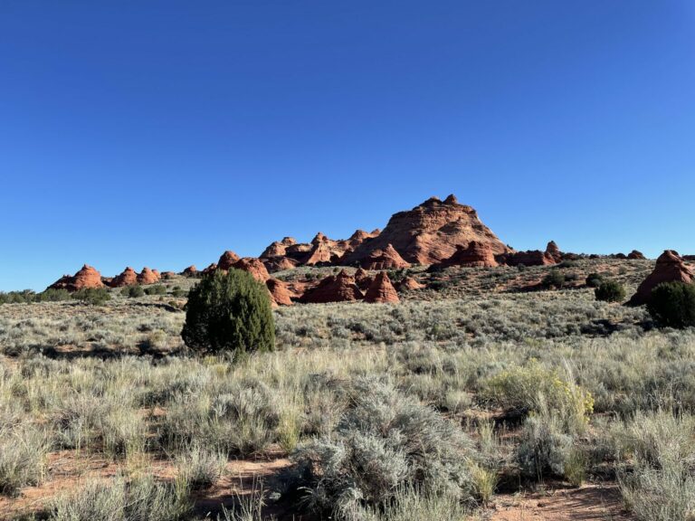
Northern end of Coyote Buttes North from along the dirt road leading to White Pocket. Of the two Coyote Butte areas with restricted access, the Northern one is the more subtle and the Southern one the more showy.